|
Mountain: None
Date: 7/13/18
Time: 6 hours
Weather: Beautiful
Miles: 9.84
Elevation Gain: 1880
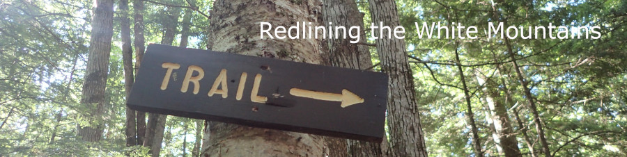
Trails:
Big Rock Cave Trail - 3.1 miles
Whitin Brook Trail - .1 miles
Old Paugus Trail - 1.8 miles
Bolles Trail - 1.9 miles
Bee Line Cutoff - .6 miles
Bickford Trail - 1.9 miles
Redline Miles: 8.4
Friday the 13th doesn't start out so great as Nancy and I begin our first push toward redlining all the trails listed in the AMC White Mountains Trail Guide. First off, I decline hiking the Beaver Brook Trail up to Moosilauke and down the Benton Trail because I am not fit enough for so much elevation gain as well as the challenges presented by the climb itself. I hate wimping out but know that tackling such a challenge will hurt my body in a big way. I text Nancy to this affect the night before and she agrees to change the trails we will hike. Her training needs are different and her fitness level is much higher than mine. She is traveling to Hawaii, spending two weeks hiking big challenging trails with her daughter Jess who is fit and in her 30s. She needs a lot of training hikes and I am a poor partner for what she feels she needs...lots of elevation gain on hard trails.
So I bow out and offer the alternative of hiking the Wonalancet Range Trail, the Warden Trail and back on the Kelley Trail. We both prepare for that hike without doing any further research. 4:30 AM comes awfully early but at least I am not hungover. We had planned to meet at Dot's Bread and Butter diner in Ashland and both arrive early. After hugs and greetings, I join her in the front seat of her Jeep and we talk about the trails... As we talk I realize we have already hiked the Wonalancet Range Trail. Damn... the tension created last night when I asked to change the route, though fairly low key, is still palpable. We spend time after ordering and after eating deciding on a different route for our first true redlining day.
Breakfast is ok. The home fries look fantastic but are lukewarm and not as tasty as we had hoped. Nancy is feeling rootless, lost, unhinged from anything meaningful in her life. She doubts that we can actually complete the redlining challenge and, in her world, she needs goals that are achievable, even if difficult. I feel less in need of full completion of the challenge but agree with her that tackling the hardest trails now is a good idea. That means a lot of driving and huge commitment. We are familiar with that. But do we want it now? In our mid-60s? Hike days without summits or views? I'm ready to give it a go, despite my lack of fitness. I will start training on Sunday!
Tough stuff to ponder and chew on as we drive down Rte. 113 toward Wonalancet. Upon arrival, we check out the Bickford trailhead and decide to return to the Cabin Trail Trailhead and start up from there. The walk back to the car from the Bickford trailhead is downhill, easier than a half mile slog uphill after a long day. Shortly after we start up the Cabin Trail we hit an intersection and start up the Big Rock Cave Trail. A bit steep at first until we reached Mt. Mexico, where things level off at 2005 feet, then head down toward the Whitin Brook Trail, passing the Big Rock Cave on the way. Very cool how those huge erratics lean against each other to form a cave.
Nancy and I are fairly quiet as we hike. I ask about her week, ask more about feeling lost, talk about the redlining challenge, share my feelings, and enjoy the bird calls and the beauty of the forest surrounding me. We reach the Whitin Brook and cross easily. The brook did not come close to presenting us with what we faced in March 2016 when we climbed Mt Paugus. It is an easy stone hop across today.
We stop and look closely at the map on this hike, realizing that we had missed a short piece of the Old Paugus Trail and have to hike up for a bit in order to come down the way we had not chosen back in 2016. We also have to hike back up the Whitin Brook Trail for a few tenths to pick up another piece we had missed and then continue down the Old Paugus Trail to the Bolles Trail. We stop often on this hike day to look at her map. I am using a GPS app called Gaia for the first time and don't know how to record a hike...but it helps keep us on track. Nancy needs time to look at and study the topo map, figure out the trails and our choices, and make sure she understands where we are going and where we have come from. I understand.
At around 12:45, we sit down on a gravel bar near a stream and eat our lunches. The sun hides and the bugs stay away as we eat. My Hannafords sandwich tastes good as do the chips. We talk about our next choices... 1.5 miles of garbage trails plus 1.9 on the Bickford Trail plus a half mile road walk back to the car or just the 1.9 Bickford Trail and half mile to the car. We start down the trail toward the Brook Trail junction, hoping to bag the 1.5 miles of garbage trails, but decide that we are done and turn around. The 1.5 miles of garbage trail will be for another day.
The Bickford Trail surprises us with a fairly long stretch of climbing before it finally starts down, actually hiking through someone's back yard and a camp, before we came back to Rte. 113A and the walk to the car. I feel well exercised, despite hiking trails that were not too steep. It is a different way for us to hike, ups and downs and all arounds, instead of up to the top and down to the bottom. I think I can get used to this - there are many summits on the docket on this redlining adventure as well.
|