For Me...Alone
Submitted by Pat
Stats
Mountains: Mts. Paugus (South Peak) (3,104) and Mexico (2,010)
Date: September 21, 2011
Time: 6.5 hours
Weather: Sunny, upper 60's, light breeze
Miles 8.1 miles plus an extra two when I got lost
Elevation Gain: 2,518
Trails: Cabin Trail, Lawrence Trail, Mt Paugus Trail, Big Rock Cave Trail, Cabin Trail
 Pinta and I start out walking up the Cabin Trail at 8:50 a.m. on a sunny, cool Wednesday in September. We're going to spend the day in the Sandwich Range exploring new trails, just Pinta, my trail dog, and me. Hiking alone isn't something I do very often and I want to feel what it's like to be in these mountains without seeing another human being for the hours that I'm in the woods. Not hiking with friends, which I have done several times this summer and enjoyed. Not hiking with Nancy, which I have done only 4 times, today included. Pinta and I start out walking up the Cabin Trail at 8:50 a.m. on a sunny, cool Wednesday in September. We're going to spend the day in the Sandwich Range exploring new trails, just Pinta, my trail dog, and me. Hiking alone isn't something I do very often and I want to feel what it's like to be in these mountains without seeing another human being for the hours that I'm in the woods. Not hiking with friends, which I have done several times this summer and enjoyed. Not hiking with Nancy, which I have done only 4 times, today included.
Shortly after starting out a hint of the day's coming warmth sends me scrambling to take off my long sleeved shirt and zip off the bottoms of my pants. Phew! That feels better. Resuming our walk, we move on a gentle uphill slope. There are blow downs to contend with but nothing that leaves me scratching my head wondering how I will get around it. I reach around for my bandana and see it is missing from its place on my backpack. I contemplate going on without it, but tune in to the sweat dripping into my eyes and decide to go back and get it. I take off my back to ease the going and head down the trail. By the time I find it I am talking to myself out loud. "Wow, I'm glad this is the only backtracking I'll have to do today."
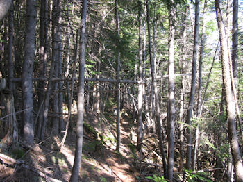
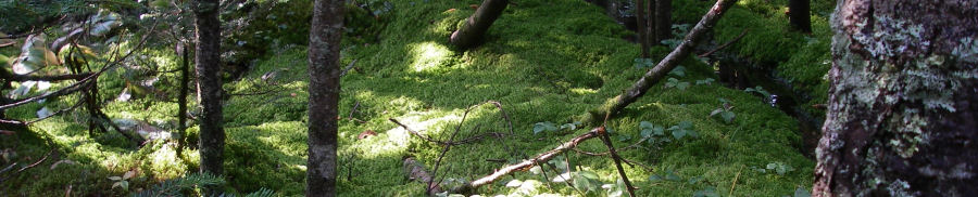
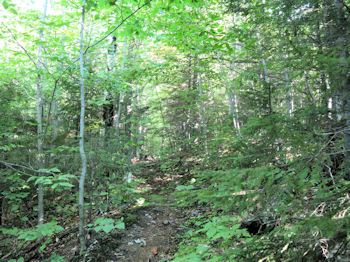
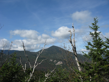
Onward on a trail through a beautiful beech and maple forest, sun dappling through the leaves, leaving bright patterns on the trail ahead. Soon we come to an intersection and take the Lawrence Trail. Vegetation and trail changes to more spruce and I am traversing the side of a hill. I am literally breaking trail through hundreds of spider webs. Yuck! It is incredibly quiet in the woods at this time of year. I hear nothing but my own boot falls. I occasionally hear a chickadee or a crow or the leaves rustling in the tree canopy above me, but mostly it is absolutely silent. To my right I can see the sheer cliffs of the south peak of Mt Paugus. I love walking along the sides of mountains and being able to see my ultimate destination. It looks so far away. This time it's not the slightest bit intimidating. I know I will be over there before I know it.
I spend some time in the early part of the hike talking to myself out loud. It helps calm and stabilize me, although I am not feeling particularly anxious. Just feeling alone. I tell myself, "You're fine. It's a beautiful day. Pinta is with you. The trail is perfect. You don't have to think about anything. You don't have to process or figure anything out. You have all that you need inside yourself." With that encouragement I walk on in silence. I take pictures to document my way, wondering why I have such a strong desire to document the passage of my boots on the trails. I don't spend much time thinking about it, heeding my earlier advice. I document. I like it. It's fine.
 The Lawrence trail soon connects with the Mt Paugus Trail and the real climbing begins. The trail is wide and in incredibly good shape. The footing is a gravelly mess of pieces of granite that has crumbled off nearby rocks. I have seen this type of footing before and remember seeing it when we climbed Mt Whiteface, our first 4,000 footer. The geology this far south is really different than the sharp, hard granite pile of boulders we hiked in the Presidential Range this summer. The small granite pieces make for excellent footing on flat trail, but is very slippery, slidey when a thin layer of them cover the rocks. Then it's an ice rink. The Lawrence trail soon connects with the Mt Paugus Trail and the real climbing begins. The trail is wide and in incredibly good shape. The footing is a gravelly mess of pieces of granite that has crumbled off nearby rocks. I have seen this type of footing before and remember seeing it when we climbed Mt Whiteface, our first 4,000 footer. The geology this far south is really different than the sharp, hard granite pile of boulders we hiked in the Presidential Range this summer. The small granite pieces make for excellent footing on flat trail, but is very slippery, slidey when a thin layer of them cover the rocks. Then it's an ice rink.
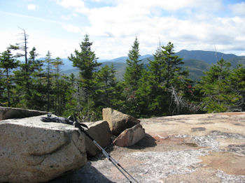
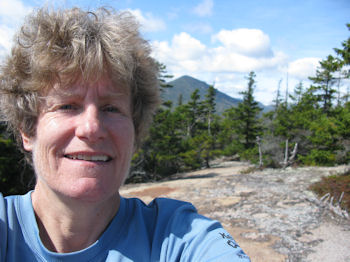
Some major trail work had been done on the upper parts of the trail, with beautiful switchbacks on the steepest parts, and great views of Mts. Whiteface and Passaconaway to my right. I stop every so often and take pictures. I stop and stand and look and let in the glory of the day. I reach the clear bald summit of Mt. Paugus (South Peak) at quarter to twelve and decide this is a perfect place for lunch. But first I spend some time looking at my compass and my GPS. The actual Mt. Paugus peak is a short bushwhack away and I can actually get a compass bearing on it from where I stand, but decide I still don't know enough to confidently bushwhack over. Soon.
I feed Pinta some biscuits for her lunch and she grins at me before lying down in the shade of a rock. I eat though am distracted by the map and the GPS. So many hoots and whistles on the GPS that I don't know anything about, if they are or need calibrating, or what they are telling me about my hike. I see I have reached 3,106 as my highest elevation. I enjoy my lunch and sit in the sun with a slight breeze keeping me cool, looking at the view. I think about Nancy. This is her 6th day in the Canyon. How are you? I miss you and it's still great to be on this mountain top by myself. Hiking alone does have its own special characteristics, and if I had to choose I would choose to hike with you...any day...anywhere. I hope you are well and drinking in everything the Canyon has to give. Today I am drinking in everything I can take in from this day.
At around 12:20 I start down the trail that's supposed to link up with the Big Rock Cave Trail. I get out my poles to save my knees and find the going very steep at first, slippery from the granite bits scattered across the rocks. Soon the walking gets easier and I make good time. I reach the turn off for the Bee Line Trail and keep going. Forty five minutes later I reach a sign facing me that says BIG ROCK CAVE TRAIL and below it in smaller letters BIG ROCK CAVE and under that an arrow pointing to my right. The trail I have been on continues straight ahead. I look at the trail to my right and take out the map, look at it, even take out my glasses so I can actually see it clearly and decide that the sign is telling me that Big Rock Cave Trail is straight ahead and the spur trail to see the Big Rock Cave is to my right. I keep walking, down and down and down until I reach another intersection. I think I am at the intersection of the Big Rock Cave Trail and the Cabin Trail, within spitting distance of the car and bear left. A brook that parallels the trail is celebrating with festive gurgles and rushing water.
 I also see lots of branches down on the trail and think to myself, I cleared all the branches on this part of the trail. Something doesn't feel right. I stop and look at the map again, still not seeing what way I should have turned. Then I take out my GPS and see I am heading due east. No. That's wrong. I'm supposed to be heading due south. I realize I'm on the wrong trail and should have taken the right at the top of the hill toward the Big Rock Cave. Bloody hell. I spin around and start trudging back up, cursing occasionally. It's steep and my legs are done with up. But I got myself into this mess so I can get myself out. I bet if Nancy had been with me I would not have made the wrong trail choice. But I did so I curse the map since it doesn't show the turn off for the Big Cave Trail as it's marked. At least not that I could see. I also see lots of branches down on the trail and think to myself, I cleared all the branches on this part of the trail. Something doesn't feel right. I stop and look at the map again, still not seeing what way I should have turned. Then I take out my GPS and see I am heading due east. No. That's wrong. I'm supposed to be heading due south. I realize I'm on the wrong trail and should have taken the right at the top of the hill toward the Big Rock Cave. Bloody hell. I spin around and start trudging back up, cursing occasionally. It's steep and my legs are done with up. But I got myself into this mess so I can get myself out. I bet if Nancy had been with me I would not have made the wrong trail choice. But I did so I curse the map since it doesn't show the turn off for the Big Cave Trail as it's marked. At least not that I could see.
We finally crest the ridge and are back at the Big Rock Cave sign. This time we turn down the blue blazed trail and immediately start climbing. Oh my god, not more up! But yes, that's what it is so we climb and climb, albeit I'm moving slowly and pouring with sweat. I drink to stay hydrated, realizing I haven't even come close to having an urge to pee. I'm drinking enough, or so I think. I'm still not convinced that I'm on the Big Rock Cave Trail when we reach the Big Rock Cave. I smell smoke from a wood fire a distance away and it becomes stronger as I near the caves. Huge rocks with perfect underhangs and vaulted ceilings make up the caves. I am tired and anxious to figure out if the trail continues so begin searching around this massive rock pile for signs of a trail. I finally find it and because I am tired and relieved to be on the right trail I continue on without taking any pictures of the caves. Interesting how the desire to document the journey wanes when anxiety rises or exhaustion starts creeping in.
And we keep hiking up and up and I watch the GPS increase elevation until we reach the summit of Mt Mexico at 2,010 feet. OK, are we done with up now? Yes, I think so and down we go. Again the geology is freakishly interesting with rocks as big as houses littering the mountainside. We reach the intersection of the Cabin Trail and head back to the car, tired, happy, and ready for a Diet Pepsi at 3:30. With a huge sigh of relief I take off my boots and sit down in the driver's seat, savoring the moment before turning the key in the ignition. What a great day! And I did it for me...alone.
Addendum: Yesterday I looked at the map for maybe the tenth time and finally saw what I had not noticed on the hike itself. The map was right. I was wrong.
|